Waste Space
Amsterdam, NL
Location: Amsterdam
Year: 2001-2002 Research and design: overview of the environmentally hindered zones within Amsterdam and what that could mean to the 2025 Structure Plan of Amsterdam.
Client: Amsterdam City Council
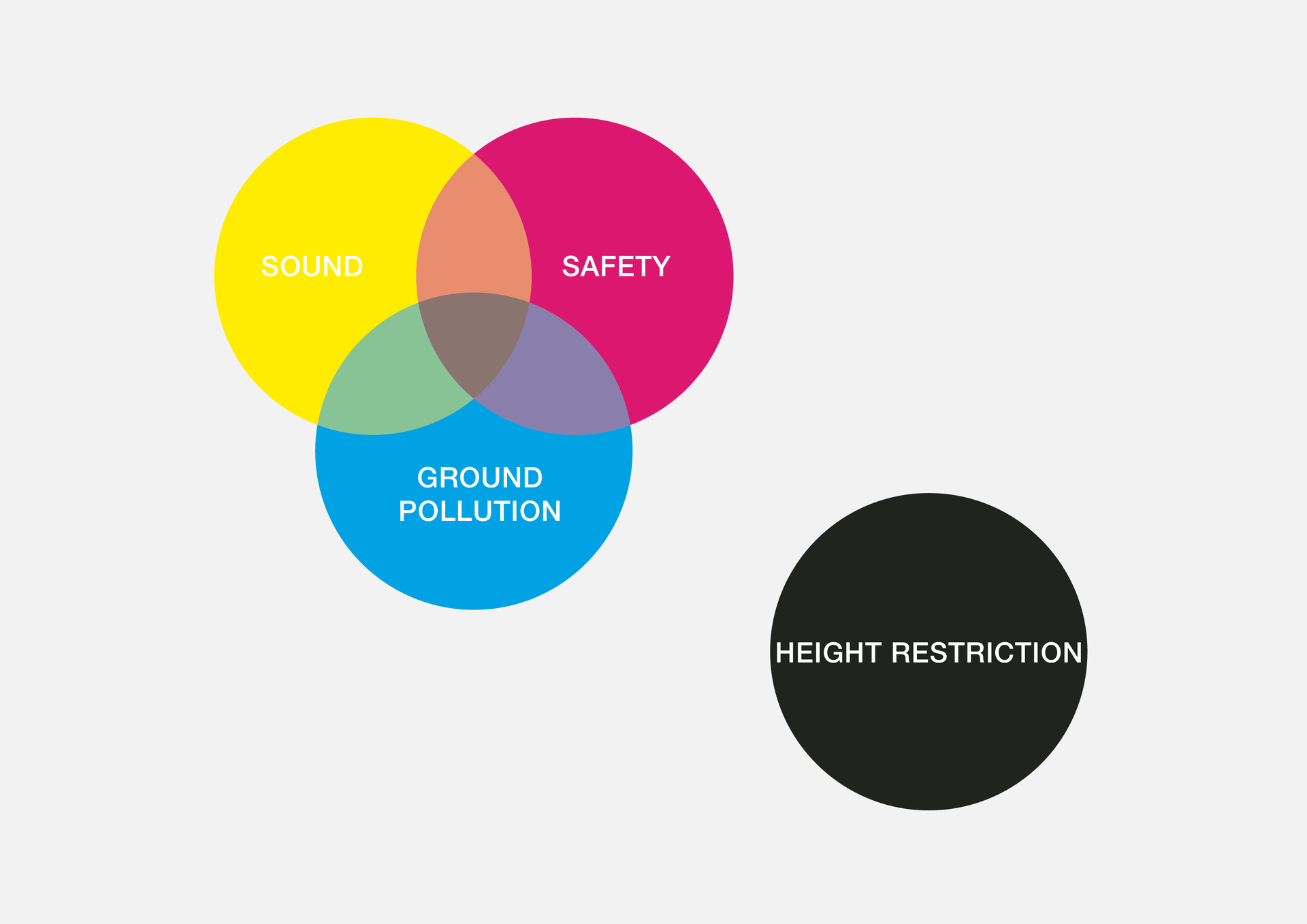
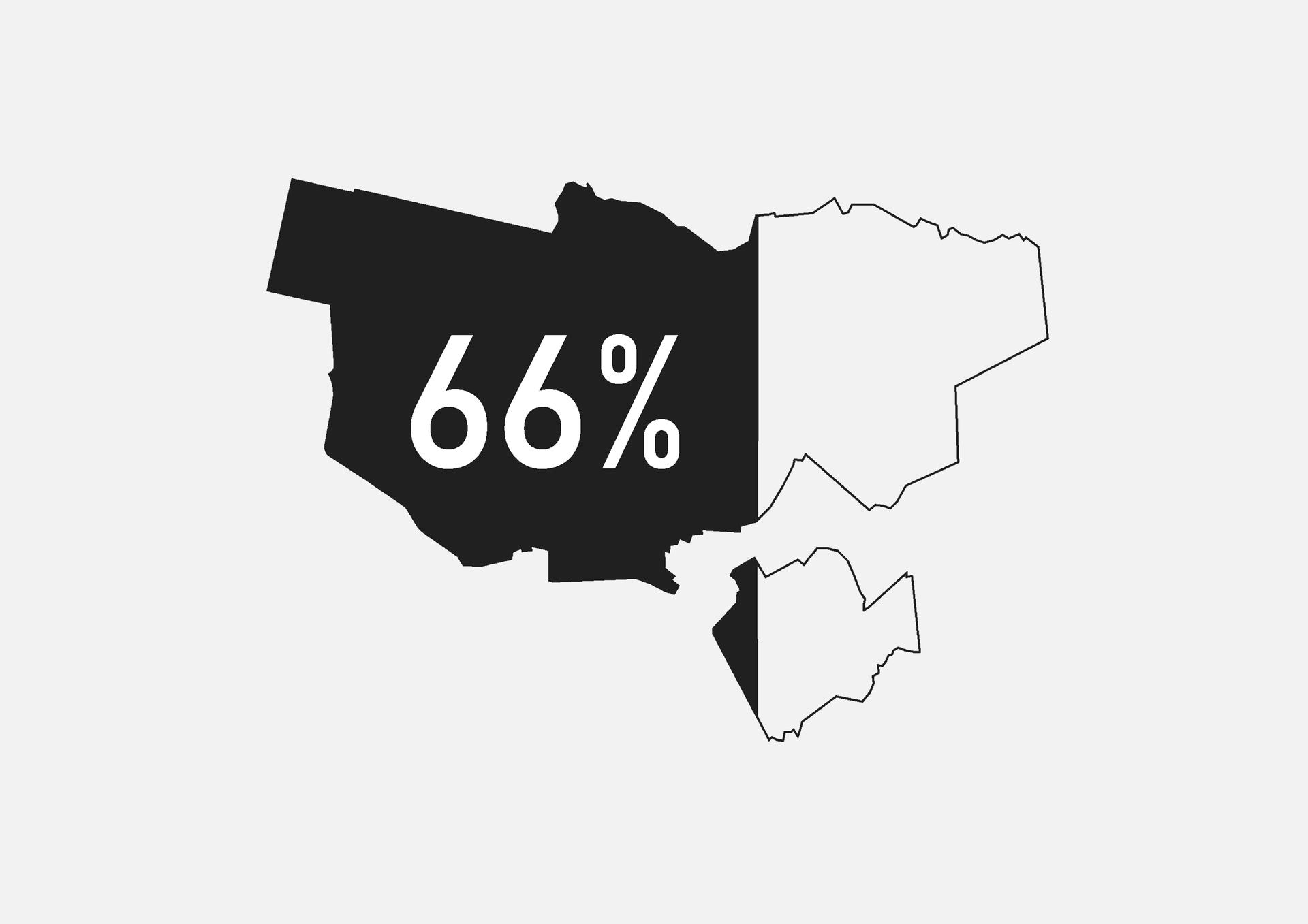
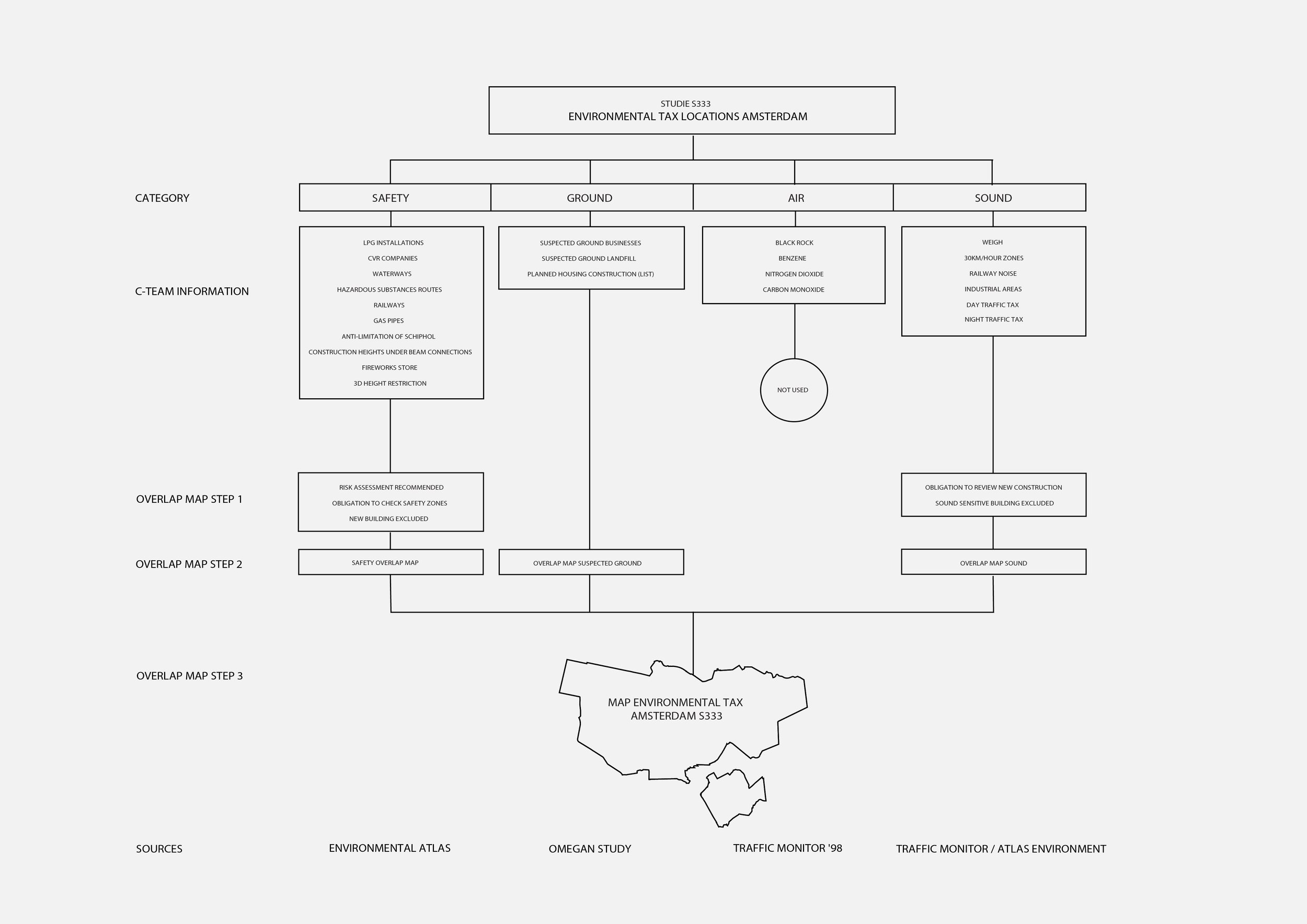
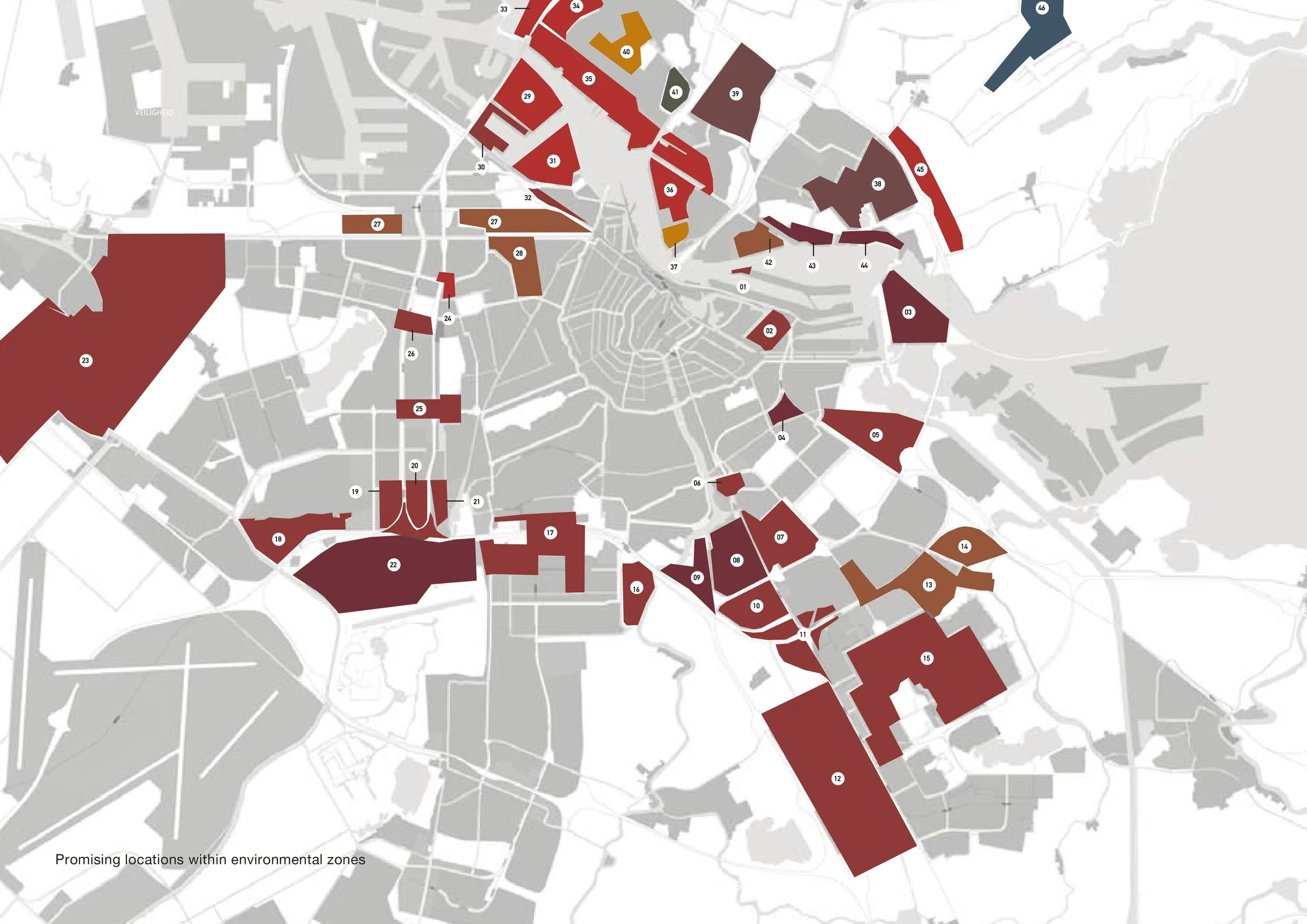
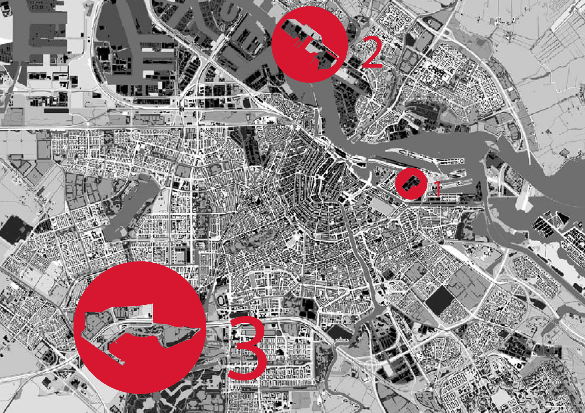
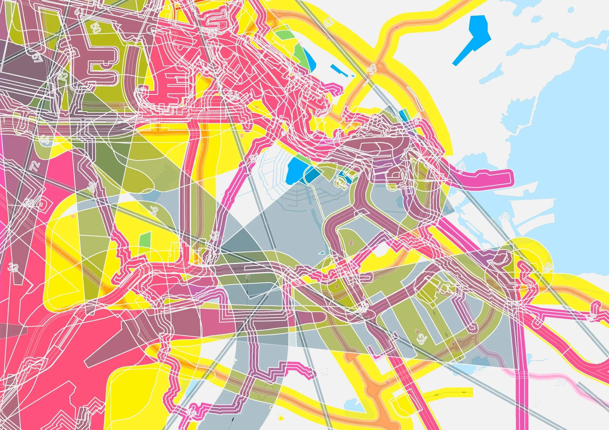
Waste Space was the first study to combine all four categories of environmental hindrance into a single cumulative map: safety zones, ground pollution, air pollution and sound. By superimposing these spatial parameters, the research revealed a striking insight: approximately 66% of Amsterdam fell within this collective “waste space”. Coupled with the city’s designated intensification areas, we identified 46 key locations and organised them within an inventory of classifications. This created a practical framework for a new way of thinking—one that escapes the paradox where environmental damage cancels out economic benefit and blocks urban coexistence. Instead of treating regulations as fixed end-checks, we developed a design-based feedback model: a set of optimisation tools that expands the range of possible solutions while improving environmental performance. From the 46 locations, three case studies were developed to test and demonstrate this methodology in concrete spatial proposals.
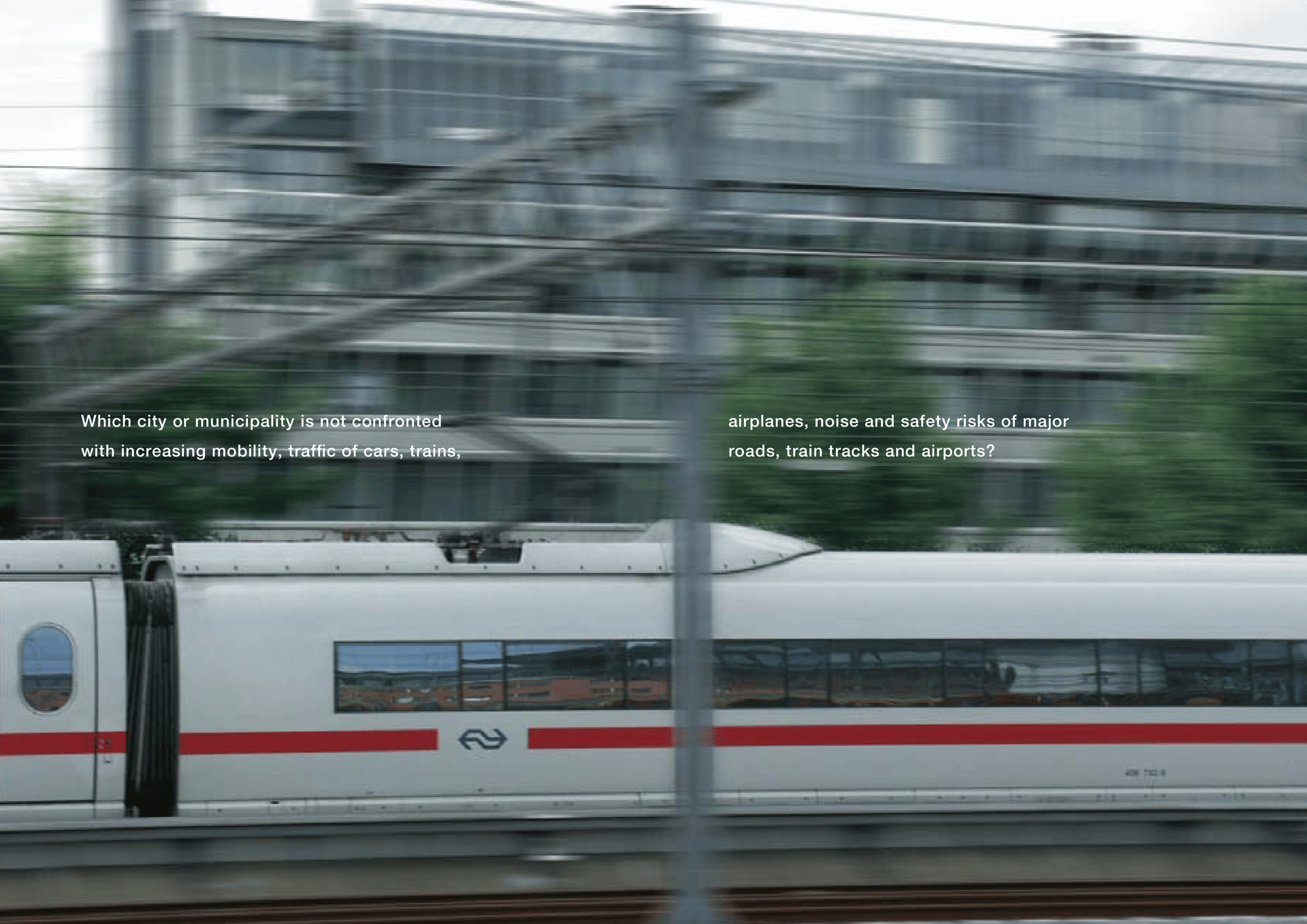
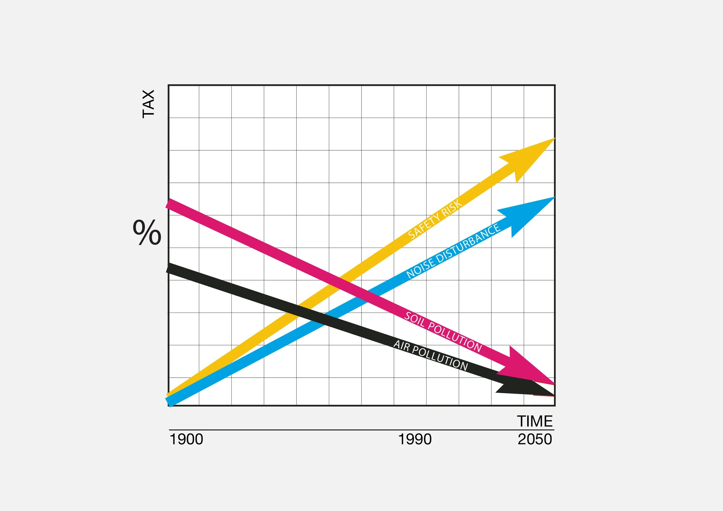
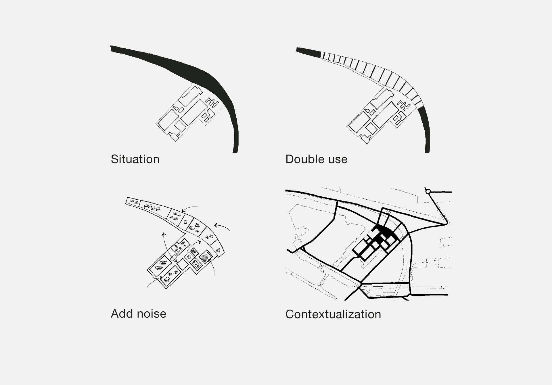
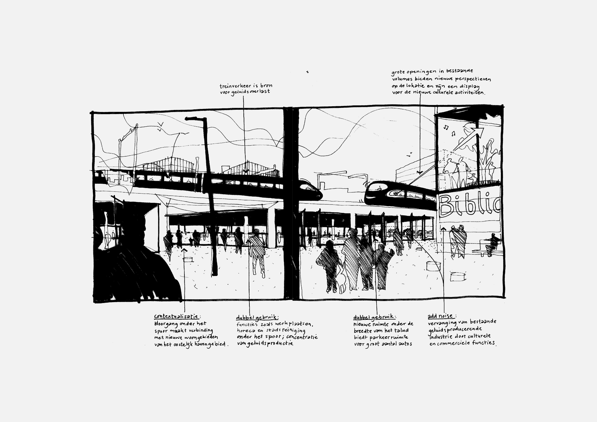
In 2001 we were commissioned to map Amsterdam’s environmentally hindered zones and evaluate what they could mean for the city’s 2025 Structure Plan. The study responded to a pressing paradox: while demand for housing within the city was rising, a large share of available land was constrained by environmental impacts generated by industry and mobility. An estimated 50,000 dwellings would need to be accommodated between 2010 and 2030 within these constrained areas. In practice, such locations were often reduced to bureaucratic constraints applied late in the process, after design was “finished”, leading to redesign, delays and missed opportunities. We proposed a shift in mindset: place the damaging source at the beginning of the design process, not at the end, so environmental conditions become a generator for urban form rather than a barrier.